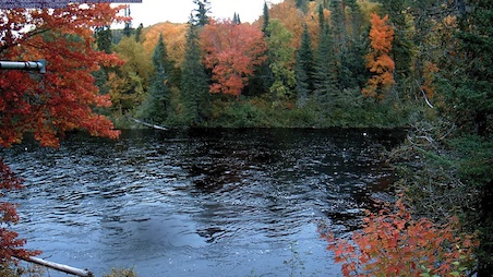
The value of monitoring bodies of water with satellite cameras
The introduction of robust, ground-based satellite camera monitoring that can operate unattended for months or years at a time has significantly enhanced the tools available to experts studying the distribution and movement of water on and below the Earth’s surface. These ruggedized satellite systems provide an invaluable visual element that complements and verifies the operation of traditional sensors, offering a clearer and more comprehensive understanding of remote and often difficult-to-access sites. This technology is crucial for a wide range of professionals, including hydrologists, water surveyors, geologists, climate change experts, environmentalists, and engineers, who study water in all its forms—whether it’s flowing rivers, vapor, snow, or ice—across diverse environments from creeks and streams to mountains and oceans.
How current and sequential photographs of remote bodies of water can mitigate disasters?
The cameras are programmed to take photographs of on-site conditions and transmit them back to hydrologists. The compilation of these photographs, taken at a user-defined schedule, provides a powerful visual of how conditions are changing. In many cases, this timely information may trigger preemptive actions, such as closing roads pending an avalanche or river flood or changing water flow through dams to prevent flooding or dam collapse, ultimately safeguarding communities and minimizing damage to infrastructure.
What we need to know about bodies of water
Hydrologists and their teams are typically situated far from the sources they monitor, making it difficult to gather crucial data to understand the site conditions accurately. During the spring runoff, ice flowing down rivers can create ice dams, leading to sensor anomalies that may obscure the real risk of sudden and severe flooding. It is essential that authorities downstream receive accurate information to take timely and appropriate action. Rapid increases in water levels can damage infrastructure, such as bridges and harbours, and cause significant erosion of riverbanks over time. Other challenges threatening public safety are presented year-round, including flooding after heavy rain, snow avalanches, and landslides. Increasingly low water levels and drought conditions are becoming a concern.
Water and weather-sensing equipment
A vast number of entities around the globe are continuously monitoring thousands of bodies of water and gathering key information using sophisticated water-sensing equipment measuring:
- Flow rates
- Depth
- Volume
- Temperature
- Quality
Data is regularly transmitted to water survey personnel through various channels. In North America, government offices dealing with climate change often rely on the GOES satellite network in areas without cell coverage. While this method is highly useful, it has limitations: the transmittal bandwidth is controlled and restricted, sometimes preventing the transmission of all desired data. Additionally, the GOES network cannot transmit images. Sensors can lose calibration or be displaced by water flow or volume, leading to distorted data. Although weather-sensing equipment also provides valuable information, it can sometimes be inaccurate. In such cases, visual confirmation of remote sites becomes especially important.
Satellite pictures complete the story
Achieving an accurate understanding of what’s happening with bodies of water at remote sites requires reliable and current data from sensors complemented by pictures. This combination of data is the next best thing to traveling to the site, which is risky, time-consuming, and expensive.
The future of hydrology monitoring
While data and weather sensors will continue to play an essential role in motoring floors, droughts, ice conditions, avalanches, and much more, remote camera technology is expected to increase as hydrologists experience the value of sequential visual pictures of remote locations. Especially remote cameras that provide additional satellite and cellular bandwidth for data and weather sensors on reliable commercial satellite networks, offering affordability and dependability.
About Nupoint Systems satellite camera systems
Aerimis camera systems, Nupoint Systems’ latest technology, offer dependable delivery of valuable images from virtually any remote location on Earth using the Iridium satellite network. Managed remotely through Nupoint’s system management client portal, these camera systems allow users to view and download images and sensor reports, manage schedules and distribution lists, assign user access levels, generate reports, and issue system commands—all from a single platform. Nupoint’s remote camera systems are designed to reliably monitor remote locations in extreme and inhospitable environments, operating unattended for months or even years with solar power. These systems provide valuable images delivered via satellite or. A compatible cellular camera system is also available. Contact Nupoint Systems for more information.


